Know Before You Go
What about fuel?
It depends on the route. For the most part fuel is available at approximately 100 mile intervals. It may require a detour from the OBCDR to reach the station. Some stations are very small and may not always be open. Service locations are listed on the maps.
What about motels?
Such luxuries are few and far between, but some are available that can change from year to year. Service is listed on maps.
How about campgrounds?
There are several primitive campgrounds listed on the maps. A couple of really nice ones are on rivers. There are also many “deer hunters” campgrounds and one can spend the night almost anywhere in the National Forest.
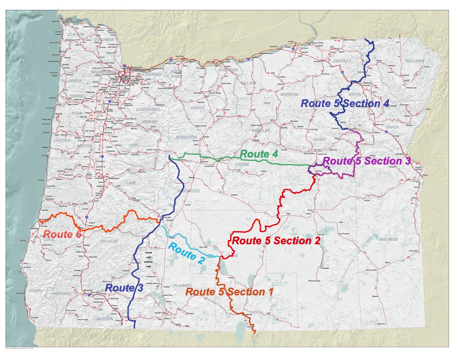
What about street legal vs. non-street legal riding?
Due to the linear nature of the system, there are locations where the only connecting road is street legal, most of those are very low levels of use, with exception of state highways, located in very vast empty country. There is simple not another road to use. Between those few sections there is a lot of miles of non-street legal riding, either as out and back or the use of support vehicles.
The most OHV friendly is Route 2. One can stage in the Crescent Jct. snow park and ride to Christmas Valley. OHV route layed out on our map. Crescent Jct., Chemult and Christmas Valley are the location of services on Route 2. The route crosses HWY 97 and the county paved road. The rest is all unpaved.
How long does it take?
There are so many variables on this one. Motorcycles will be the fastest. Quads are next, with full size vehicles the slowest. It also depends on what a person enjoys: the challenge of speed or smelling the roses approach.
One hundred miles in full size vehicles is a full day. Navigation is part of the challenge; allow time for mistakes.
What is the best time to go?
The OBCDR is 4000 feet and above with some passes over 6000 feet. Every year will be different depending on snow melt and which route, as some go higher than others. The roads will be open from snow melting in the spring to snow falling in the winter. Early will have many mosquitoes so remember the repellent. Later will be very dusty. Plan on plenty of separation between units. Generally the last couple of weeks of June will be the earliest and then some of the 6000 feet to 7000 feet areas could still have snow.
During fire season one is required to carry a shovel, fire extinguisher and some thing to carry water. Great caution is required during fire season. This will vary from year to year as well. Sometimes the forest will be closed to all use. Be sure to find out before you leave by calling the land managers.
How detailed are the maps?
We start with a USGS digital base map. On that we overlay the routes with road information, services location information and add GPS points at road junctions.
What maps should I take?
The OBCDR maps for sure. It is advised to carry the National Forest maps. In case of an emergency, road blockage, I.e. trees down, finding a re-route or the shortest way out is not on the OBCDR maps and you will need the Forest Service maps.
How many other users will I see?
If you see any others it will be an extremely rare event, except around towns. One needs to be self-sufficient with careful planning. It is not advised not to travel alone. You will come to a new understanding of just how BIG Oregon is and how much emptiness there is in the back country. There are miles upon miles of incredible country with no other human in sight.
Why Paper Maps?
Why do we offer maps instead of GPS routes? Safety. The GPS companies discourage using GPS units as the only means of navigation. Stories of GPS unit failures are easy to come by. Reports of vehicle failures on the BCDR have been heard and experienced. We strongly recommend one carry Forest Service maps as well. Your journey will be one with few if any contacts with others outside your party. One needs to plan for being self-sufficient. Traveling with others is highly recommended. If one’s means of transport fails, it can be a really, really long hike, and it could be many days before someone comes along, if at all. Some areas have cell phone reception but should not be counted on. If it becomes necessary to find civilization in a hurry, for any reason, you will be thankful for all the maps and resources along with you.